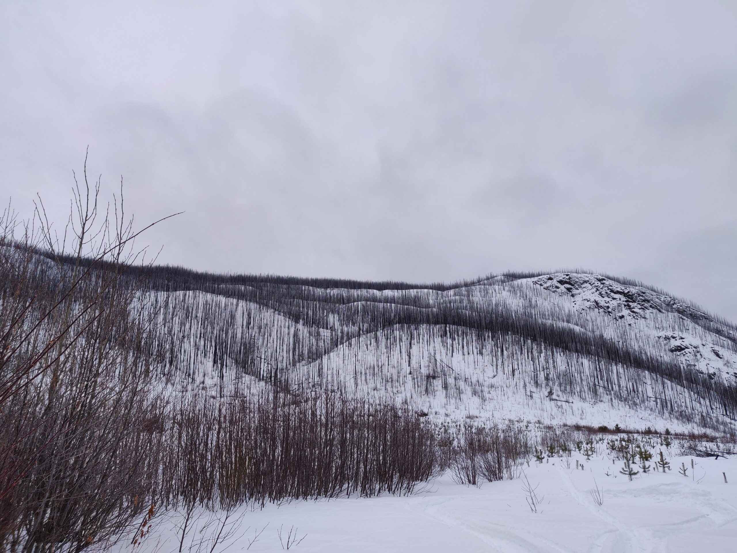
On the highway between Burns Lake and Houston there are a couple of spots just east of Topley where if one looks to the south, they will see a large hill on the horizon that appears to be cut directly in half. It’s a place called China Nose (not sure how it got the name), a unique geologic formation where this bald rocky hill has been cut away and fallen apart to create a massive vertical face on the north aspect.
What makes this location doubly interesting is that most of the hill was engulfed in wildfire in 2014. I’ve driven past it a few times this winter and thought that one could probably ski that burnt slope. Hiking it in summer is interesting, but being able to ski low elevation slopes in such a unique location was very intriguing. Though it hasn’t been a very good year for low elevation snow, the opportunity for me to ski it came by this weekend. It certainly wasn’t as great as alpine skiing, but it was a great adventure none the less!
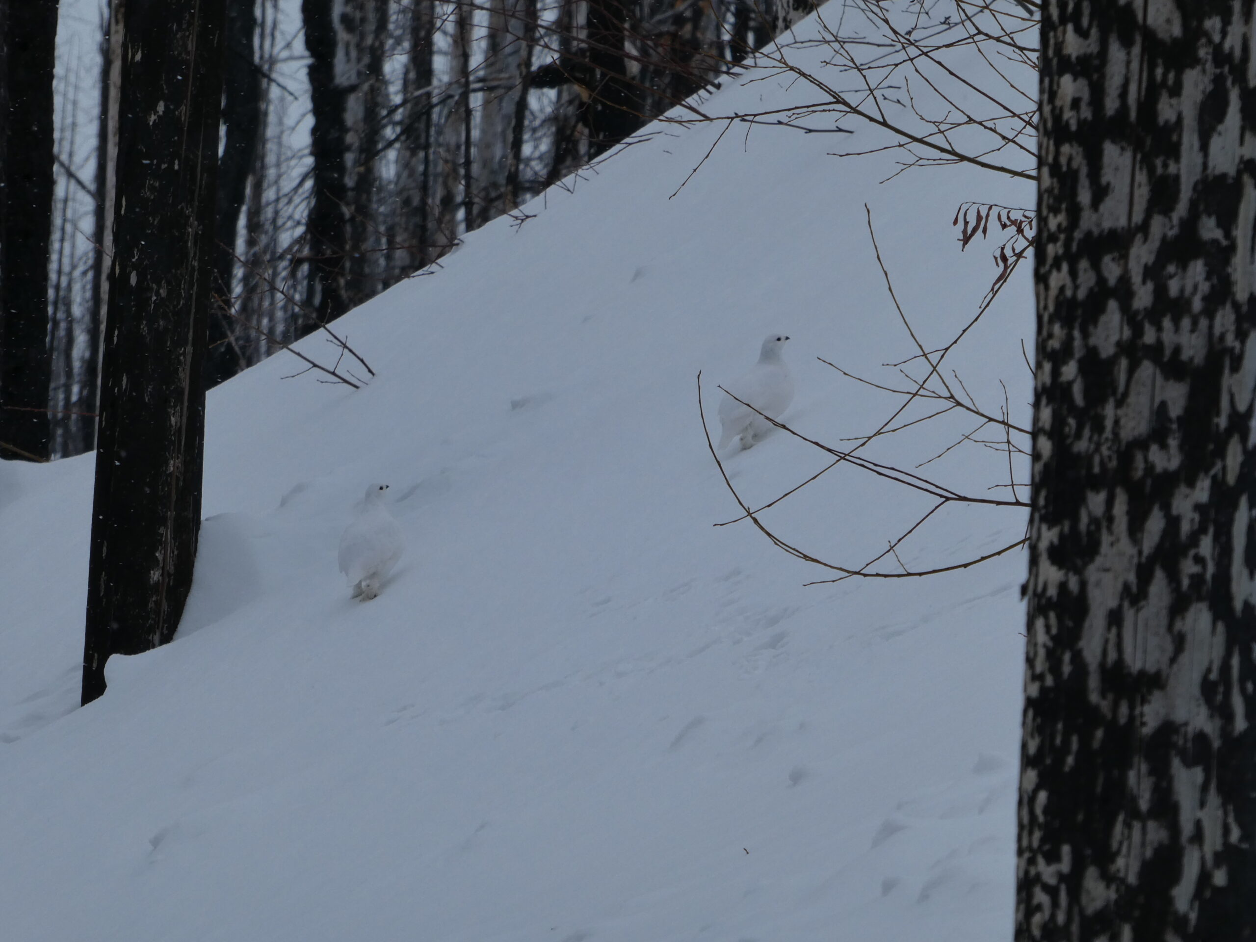
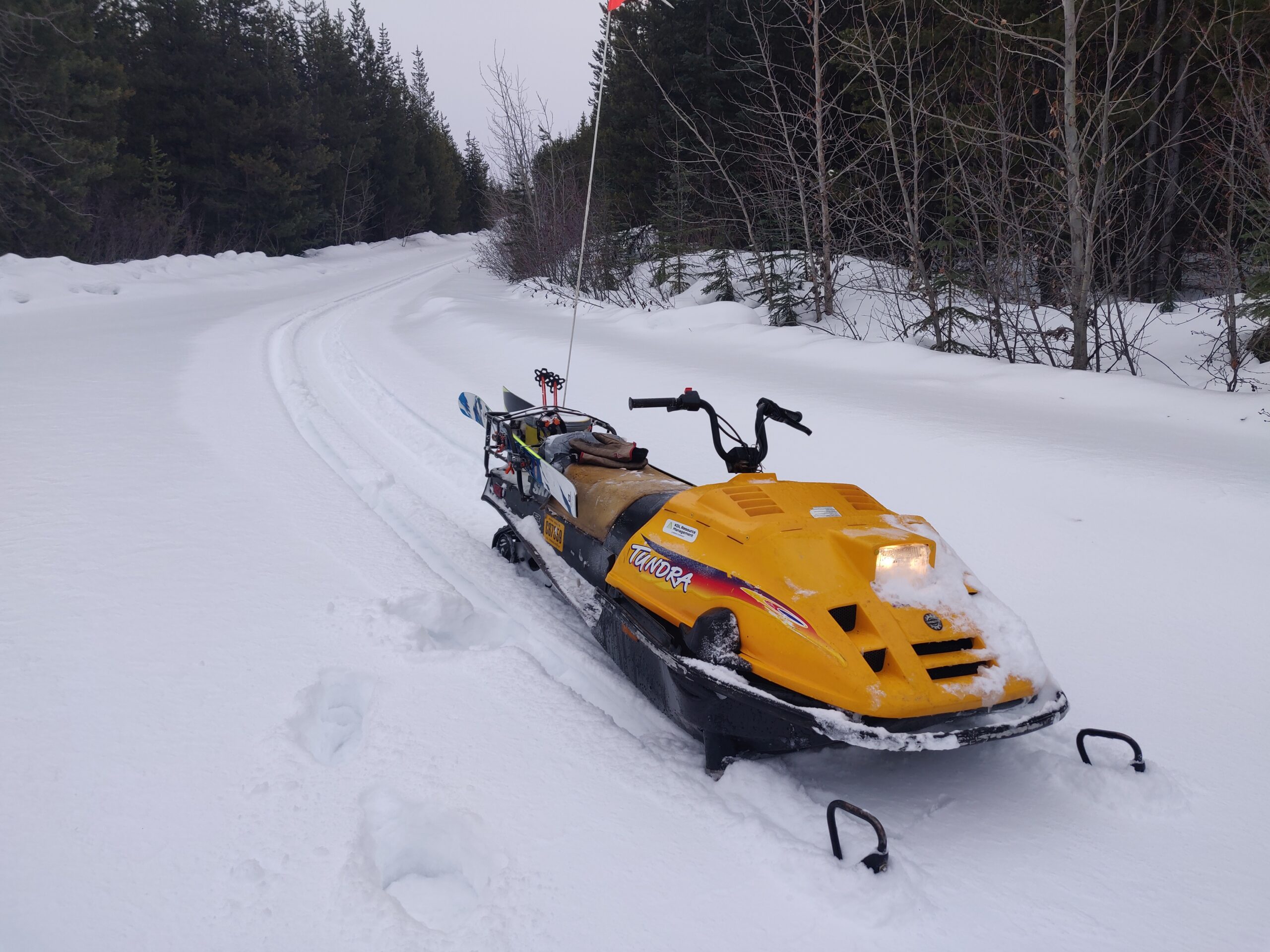
Getting to the base was a labyrinth of forest roads, starting with the Forestdale Canyon road across from Broman Lake. From there it was the Crow Creek road on to the Maxan-China Nose FSR where the ploughing stopped. 12km of sledding landed me at the NE toe of China Nose where I began my ascent. The lower slope snow was pretty brutal, a thin ice crust on top of structureless sugary snow. It was also heavily wind modified before the ice crust formed, so the uptrack could go from hard pack to thigh deep sugar without warning. Because of the punchy snow and my slow climbing, the uptrack took about 1.75 hours. Along the way I ran into a family of 5 ptarmigans, heard a pack of wolves howling below me, and passed many beautifully charred trees on some fascinating terrain.
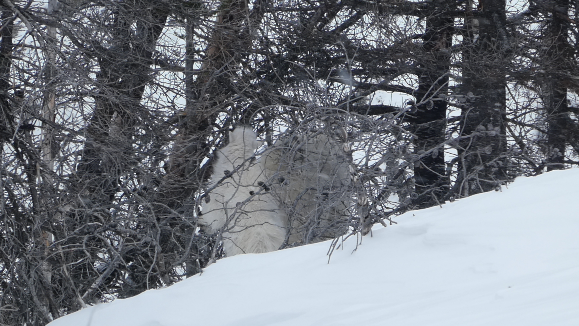
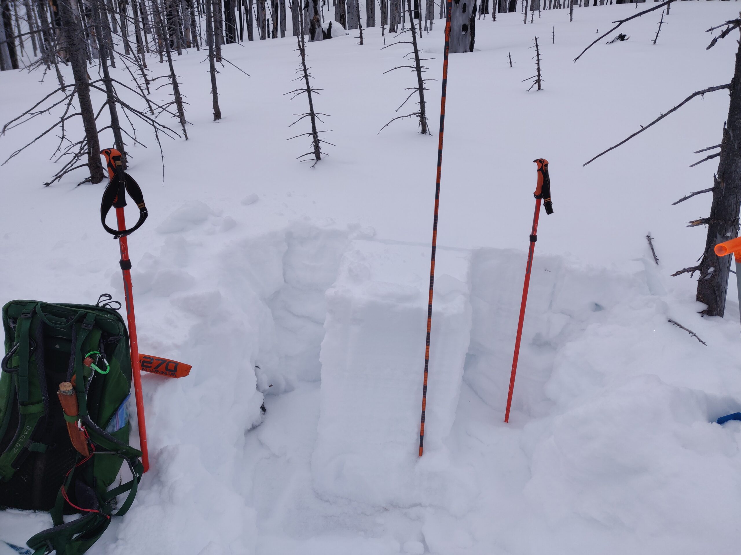
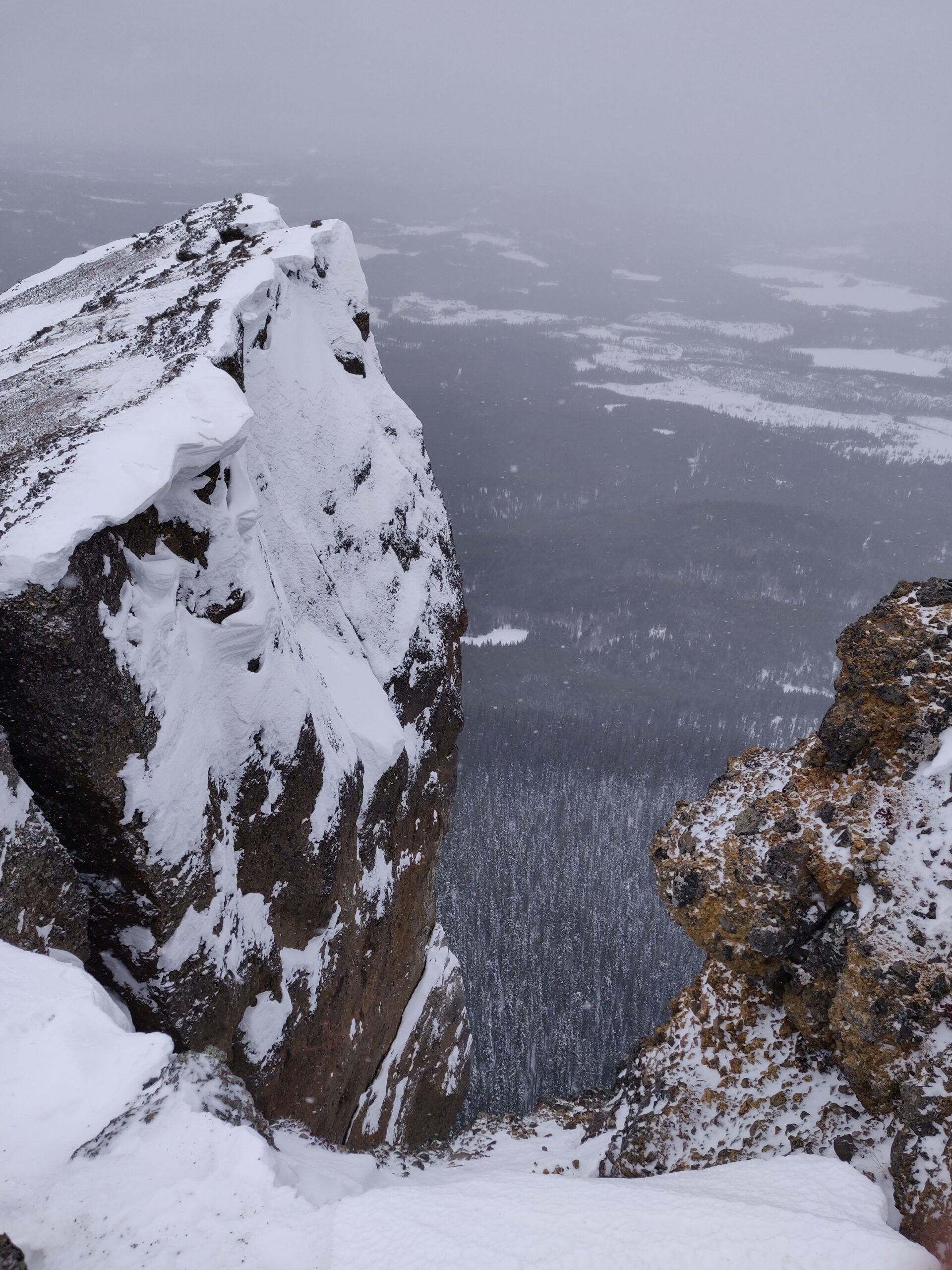
Once at the top I took some time to traverse to the cliff top. Near the cliff I saw two mountain goats, a nanny and her kid, eating buds off the few green balsam trees near the ridge top. I managed to get one moderate photo before they saw me and left. The cliff top was very windy and the visibility was pretty poor. Certainly a better spot to visit in summer. I dug an avy pit near before descending, the snow was pretty thin at 1m deep. There was a buried ice layer at 20cm, but it was pretty well bonded with the snow above. Some of the bald steep ledges along the way did show signs of sloughing surface snow, and I did have some snow “whump” on me near the top.
For my descent I made sure to stick close to my uptrack. I saw a lot of exposed rock features and nasty gullies along the way and didn’t want to get stuck in a terrain trap. The uptrack was purposely woven up the most promising terrain. Going down was of course a lot of fun, but it sure was tight between the trees! Certainly a downside to skiing lower elevation forests, even if they are completely cooked. The snow was also very fast but hard to carve making for some real thigh burner conditions. My lines were pretty slow and conservative, didn’t want to take risks when solo and this remote. The descent took about 15min.
I could see this being a good day trip for folks living in Burns Lake when the snow is in good shape. I could also see some good lap potential on the burned cut blocks on the SE side of the mountain. Overall, Im very glad that I skied this hill before it grows up again, but it certainly isn’t the same as skiing nice open alpine lines! It had a lot for extra value for me who loves spending time in burnt forests and gazing at the mountain as I drive by on the highway