It was the best of times; it was the worst of times…. Or was it the other way around? Hard to tell and we tend to have poor memories when it comes to these types of things. Either way it was a roller coaster of emotions from the elation of discovery and potential of a new area (to us), to the depths of despair as we were slowly consumed by the dense and endless jungles of devils club.
It all started when our intrepid explores Andrea, Hardy, and Tim thought it would be a good idea to do a simple little trip into Snowshoe Lake one August weekend. The Snowshoe Lake area is located in the Cariboo Mountains near Ptarmigan Creek Provincial Park, and in the vicinity of Capra Glacier. Capra Glacier being one of the closest glaciers to Prince George. At least in the top two.
Tim and his buddy Travis had flagged an old trail into the lake a year or two earlier in late fall, and Hardy had also been in the area on a winter ski trip. These little forays into the area were just samplers, and all felt further reconnaissance was warranted. As we piled out of Hardy’s car parked at the start of an old overgrown in-block logging road, we looked up at the distant mountains and Snowshoe Creek Valley with light spirits and exuberance.
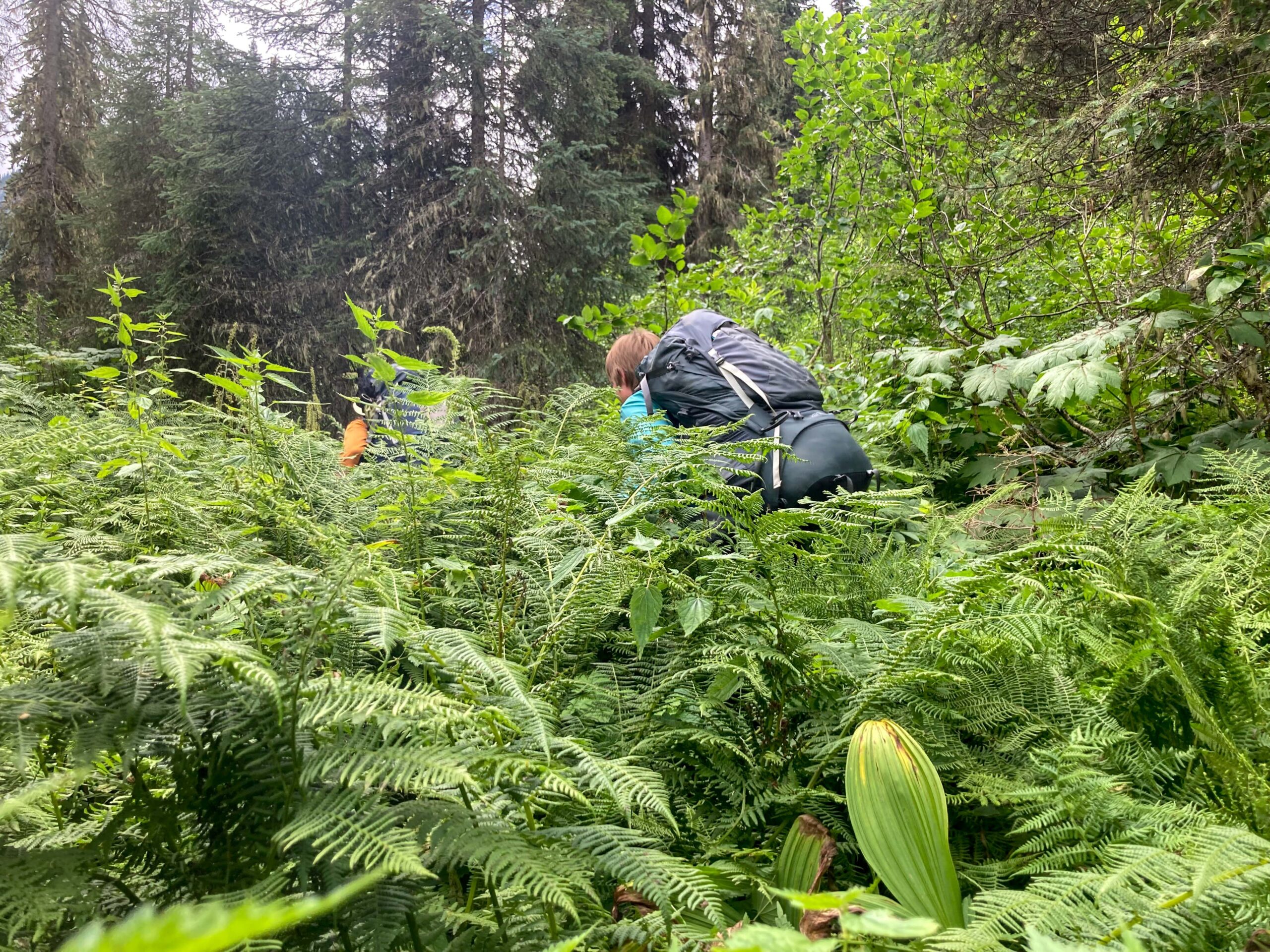
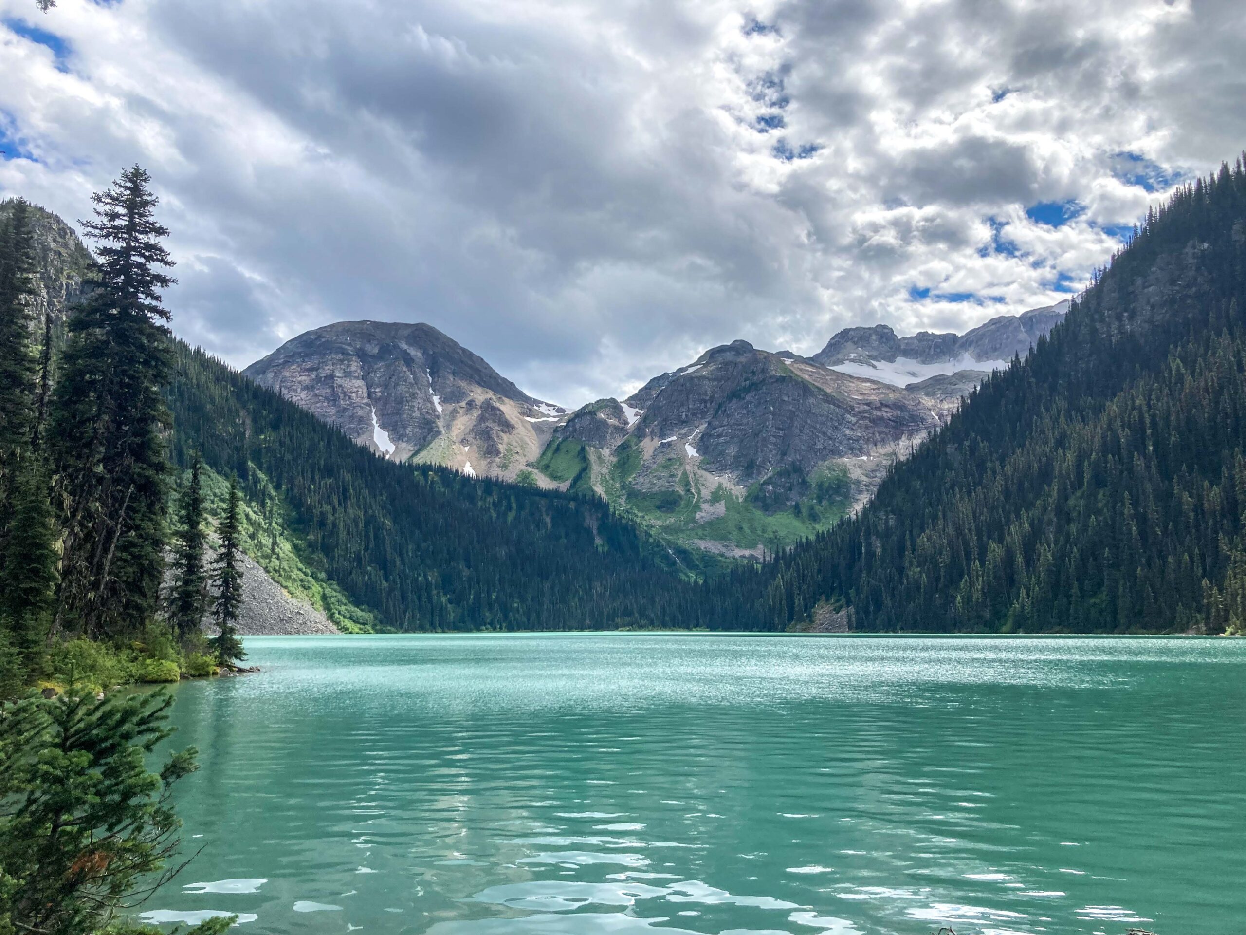
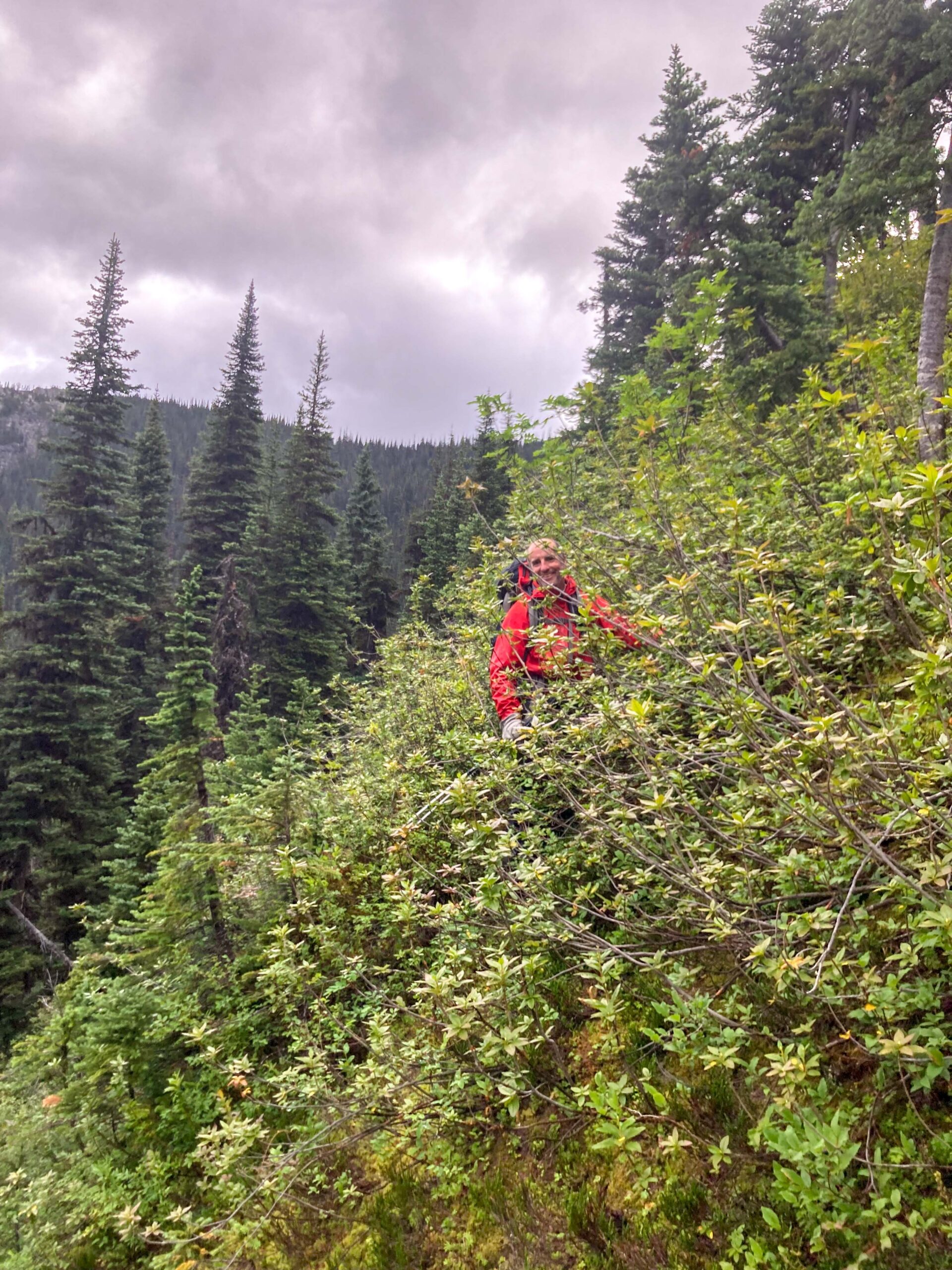
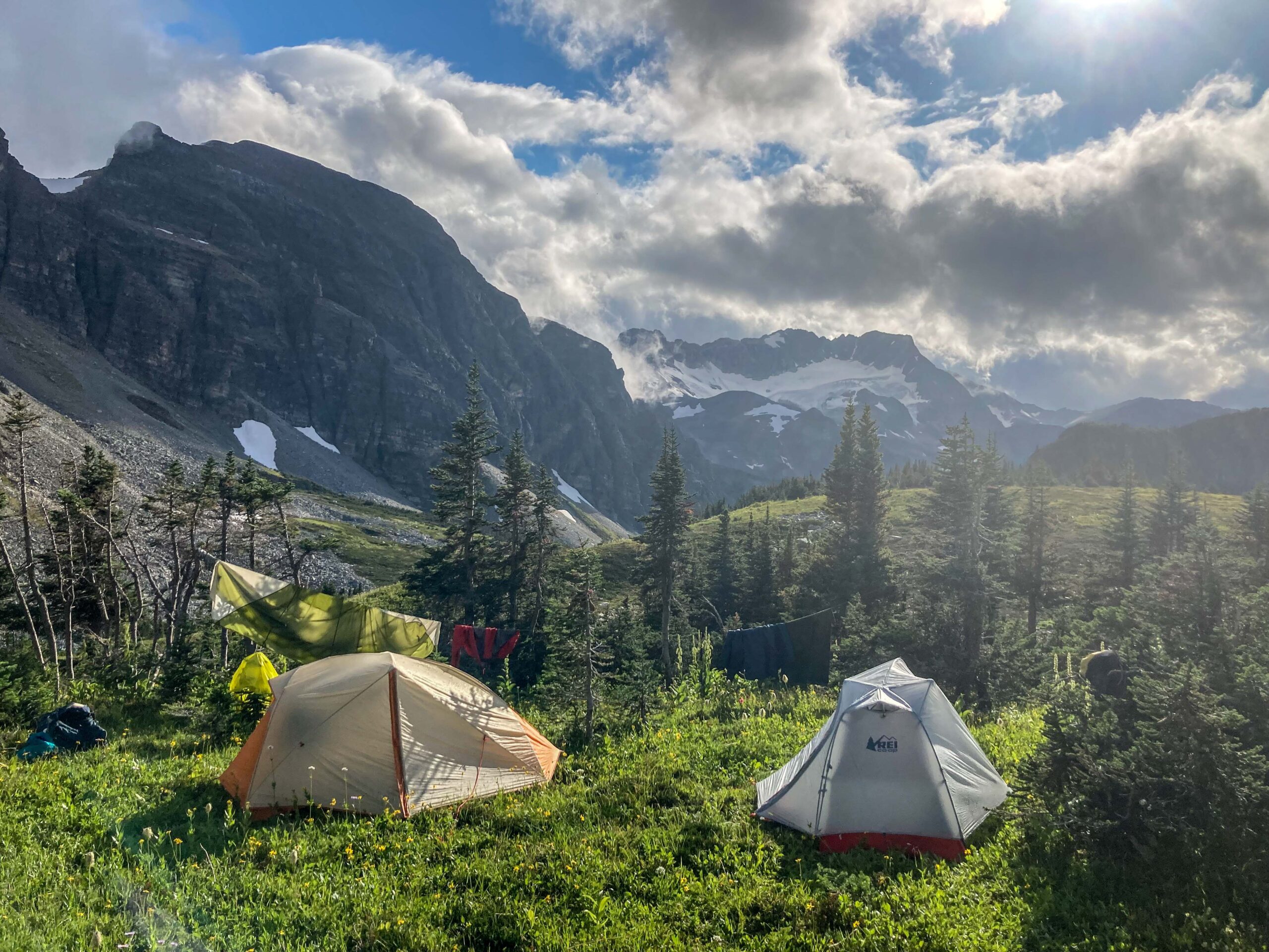
The first 6 km on the old road was as expected, and at times it was easier to walk through the second growth forest then through the tangle of alder and willow on the road. Once on the old trail winding up the valley through a nice hemlock forest, things seemed to be going our way. However, as we continued further up the valley the alder and devils club became thicker and thicker, and route finding become a challenge. As we were engulfed in the spinney Jurassic nightmare, Tim could be heard muttering to himself “hmmm… I just don’t remember it being this bad…” However, roughly a further 6 km and a couple questionable log crossing later, the thorn riddled and somewhat traumatized trio were greeted by the azure waters of Snowshoe Lake. Another kilometer or so along the steep talus shoreline and the crew were able to put their packs down at a nice little camping spot at the far end of the lake.
At dinner we sat around contemplating the day, and placing bets on how many months it would be before the last devils club spine would finally be removed. Although in good spirits and humour, we were all thinking “Geeze….that was really quite horrible. I really do not know if I want to go back down through that.” We had originally thought that this would make a great hiking destination with visions of a more established route or trail in the future, but that bubble had felt like it had been popped (likely from a devils club spine). The general consensus was that it would unlikely that we would be making a return summer trip anytime soon… if ever. However, given time, and our apparently short memory for discomfort I was willing to bet come next winter we would be looking at maps, playing in Google Earth, pulling up trip photos, scheming our next visit.
Looking up from the lake we could see Zig Zag Ridge, when the idea came to the group. “What if tomorrow we just pop up to the pass overlooking Capra to get a look at the glacier and then scamper around to Zig Zag, and then the next day we can just zip down to the highway and walk the road back to the car.” If you say it fast enough it seems, easy right?
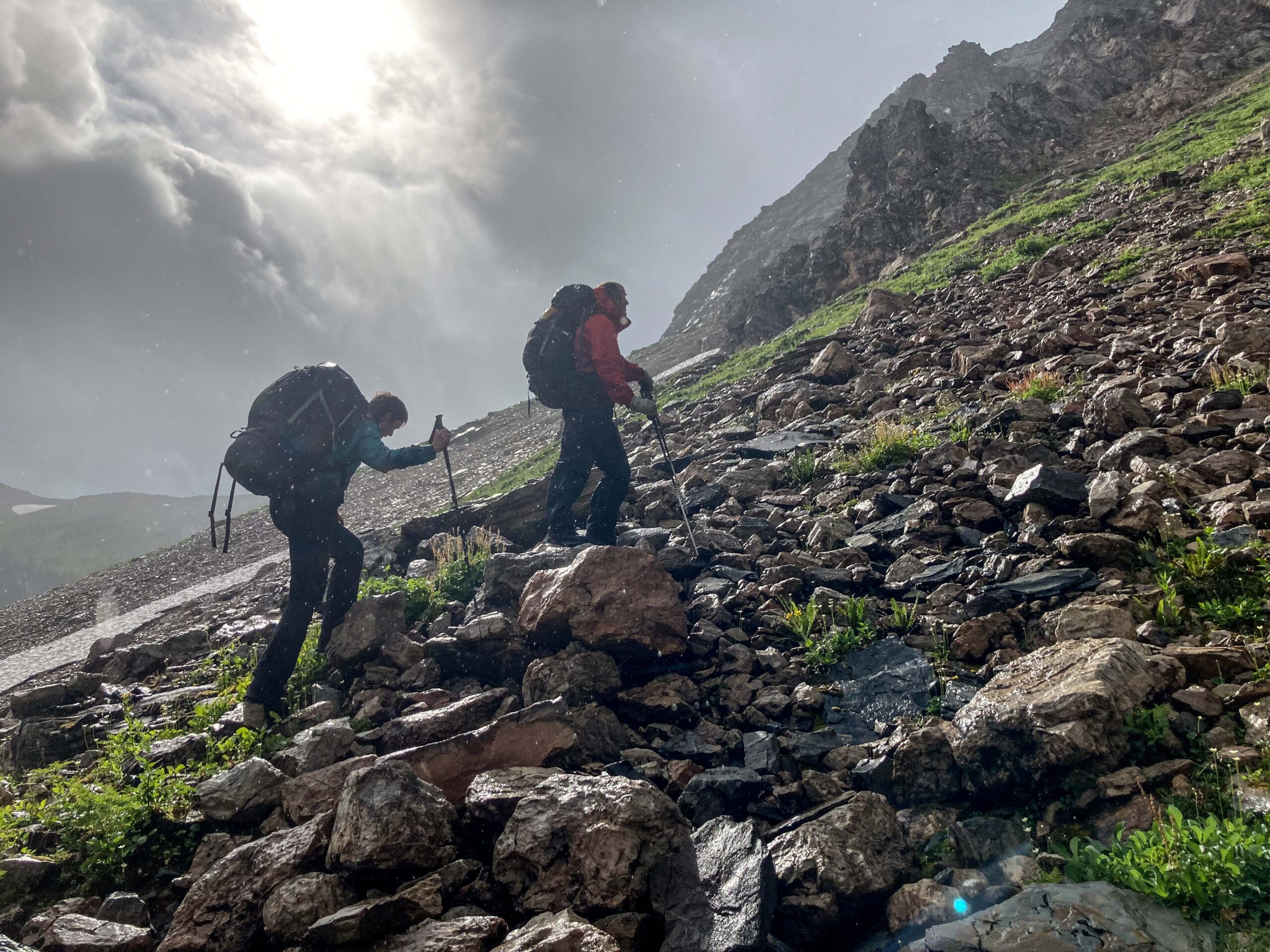
After a rainy night the crew got up, had breakfast and started up to the pass. As we clung to the edge of steep slopes and pulled ourselves up through the wet dense rhododendron, we commented on how this route seemed easier much in our minds the night before.
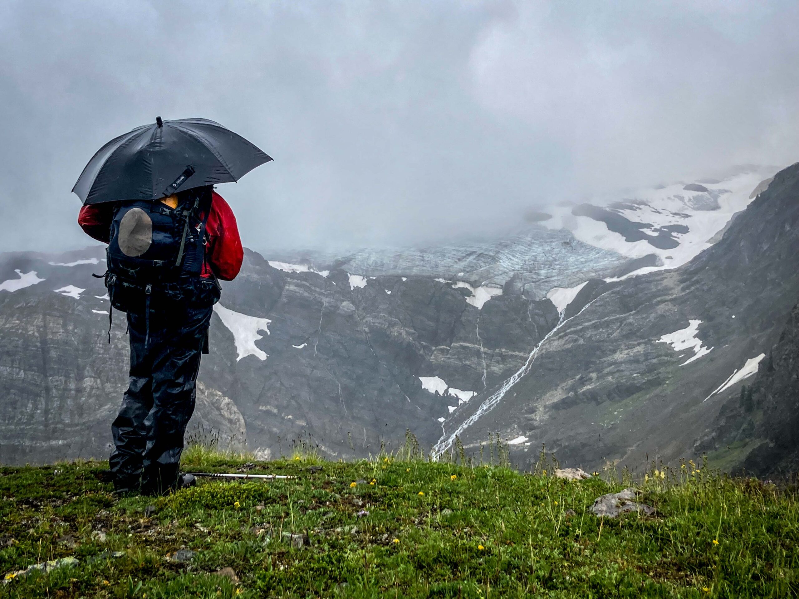
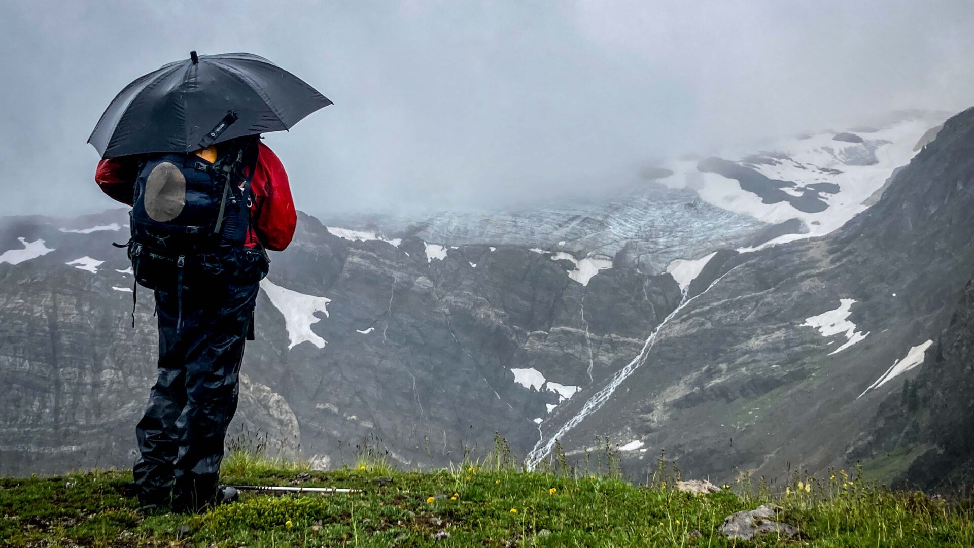
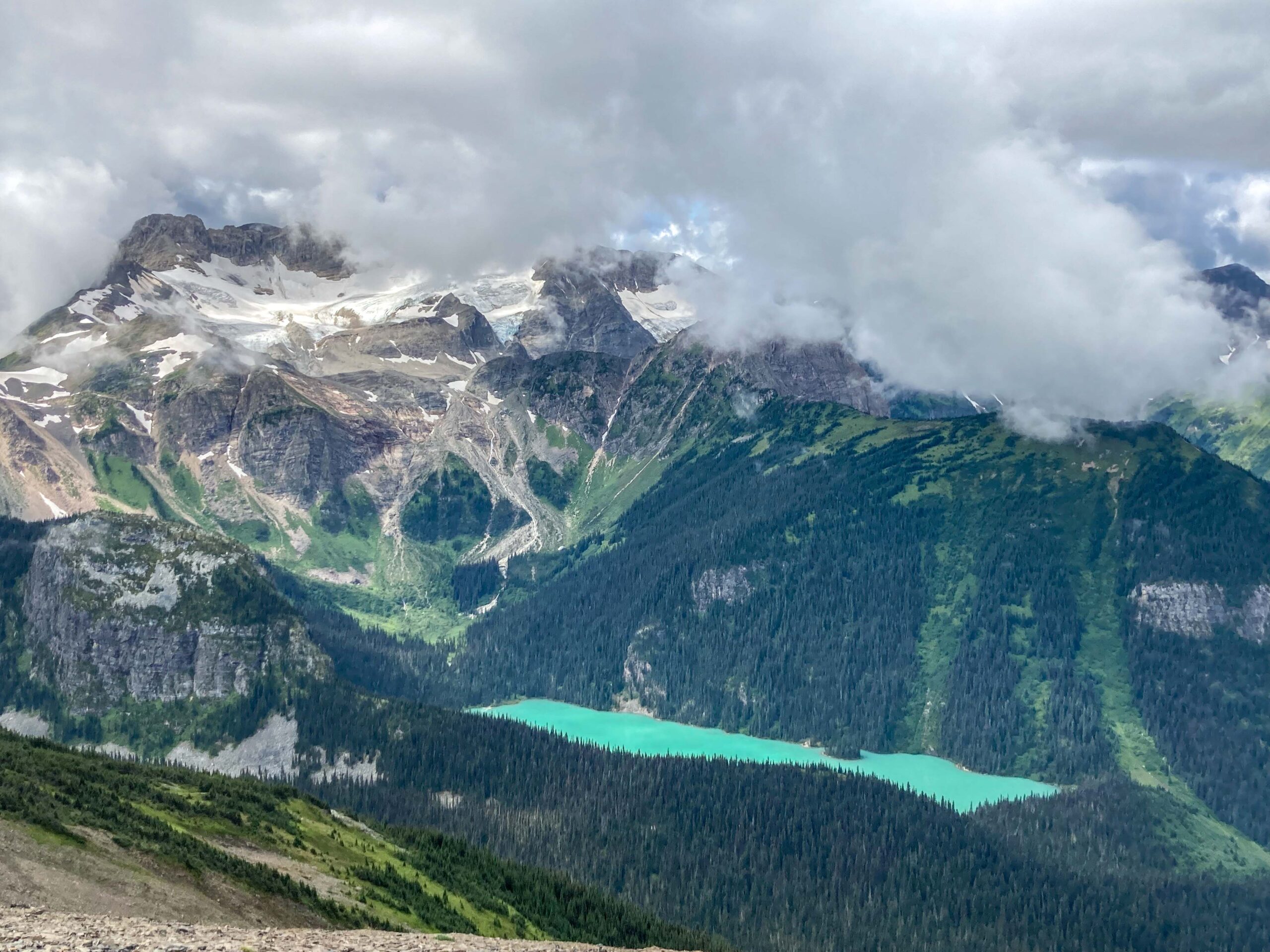
We made it up to the pass in time for the wind and the rain to really kick in. This was my first introduction to the “hiking umbrella”, as Hardy pulled one from his pack. Perhaps in a different circumstance there may have been some good natured mocking at such an item; however the fact that I was being pelted by sideways rain as Hardy had a content satisfied smile on his face told me this was not the time. From the pass we could look down at the Kendall Creek valley, pondering if it would be easier to access the area from the Goat River. Unfortunately the clouds were obscuring the glacier, but every now and again they would lift just enough to reveal the ice and let us know it was there. The driving rain was pretty cold and unpleasant and we did not linger too long knowing that we still have quite trek to get to Zig Zag Ridge.
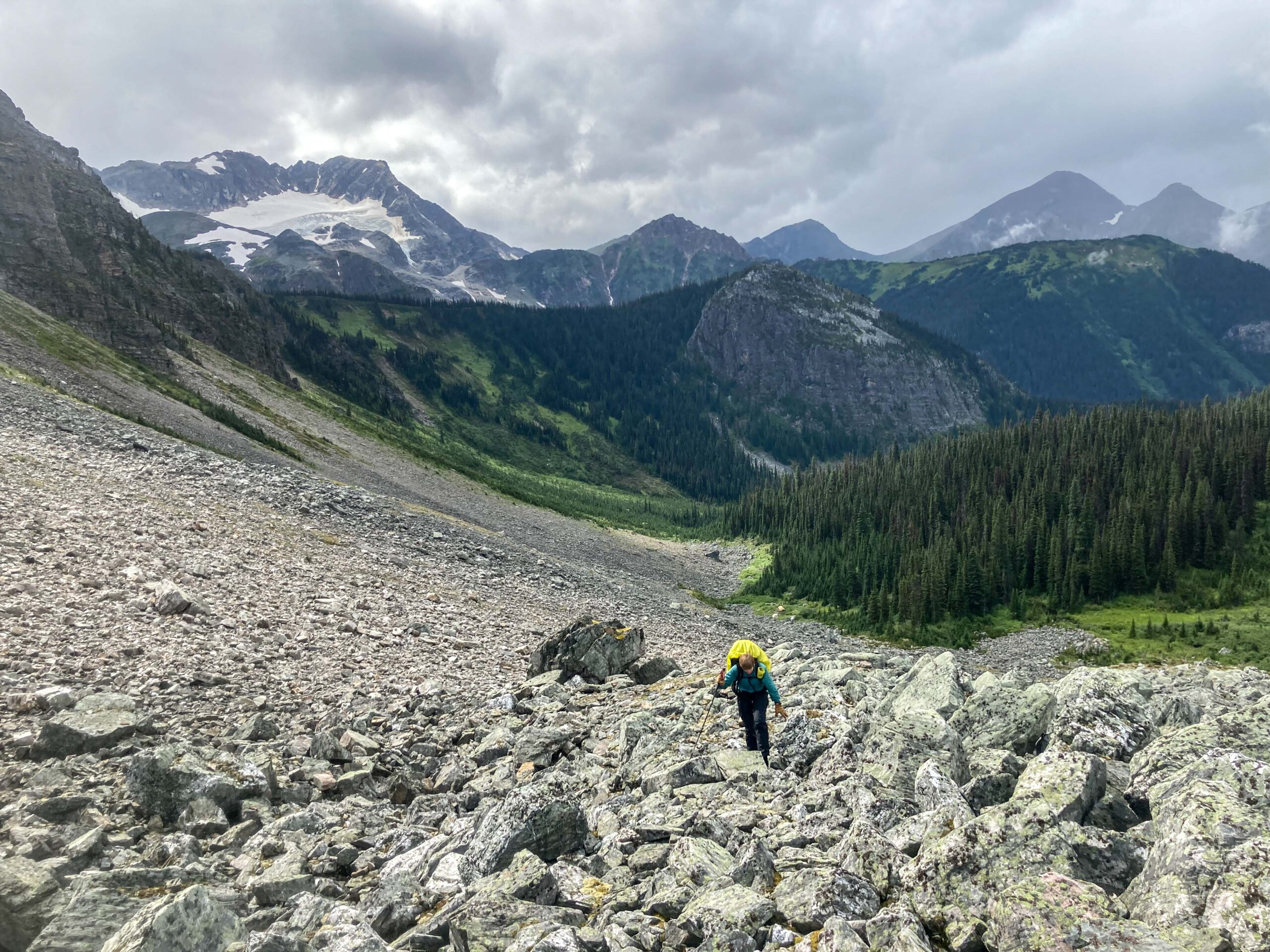
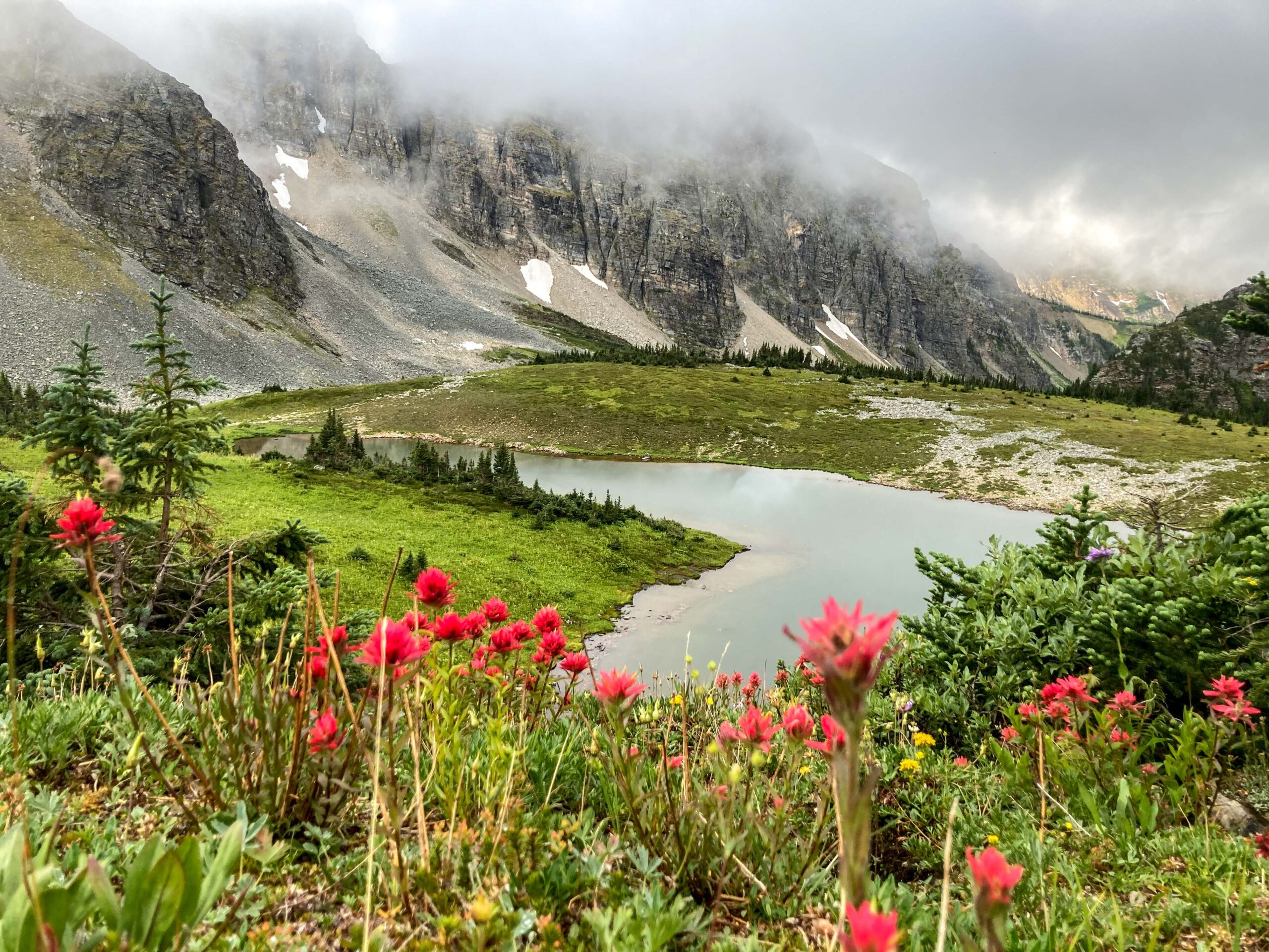
From the pass we spent the remainder of the day working our way up and down ridges and through boulder fields around the base of what Google Earth calls Capra E4. Eventually we found ourselves at the edge of a small alpine lake on the south side of Zig Zag Ridge. What a beauty of a spot! The skies had cleared during the day and we had renewed excitement and enthusiasm for the area, with even talk of future trips. We set up camp and enjoyed the mountain vistas for the remainder of the evening.
The next day we hiked to the ridge and followed it around, taking time to soak up the last views of the area before popping over the ridge towards the highway. We were in no big rush and felt that it would not take all that long to get back to the road. Our mutual friend Travis had been refining a route to Zig Zag Ridge for a number of years, and each of us had been to Zig Zag Ridge with Travis on separate occasions. As it turned each of us had taken a different version of the route as it evolved. Hardy had an old GPS track file that two out of the three of us thought was close enough and seemed about right. Andrea felt that the direction we were contemplating was not the way she had gone up last time, which she recalled was quite reasonable. Unfortunately for the group we Zigged when we should have Zagged.
As we descended off the mountain the first major obstacle was an old cut block consisting of thick regen and shrubs. Wading through the brush was a challenge and made it impossible to see the old slash and stumps. On the plus side many of the shrubs were blueberry and huckleberry. As Hardy charged forward leading the way, Tim and Andrea were busy grazing on berries. Although the cutblock was only 750 m wide, going was slow. Tim recalled that he and Travis had once gone up through the cutblock before in early spring, and he now conveniently recalled it being a tough slog that should be avoided. Obviously that traumatic memory had been long repressed as a coping mechanism.
Once through the cutblock, the next step was to continue through a forested section for another 2 km or so to the valley bottom. Seemed easy enough. All we had to do was follow the top of a ravine, keeping it to our left. As we continued down through the forest things were not looking quite right and terrain was leading us away from the ravine; however we found some ribbons that seemed to be going downhill and knew that we would get to the bottom, and from there should not have any problem connecting to an old road that would lead us out.
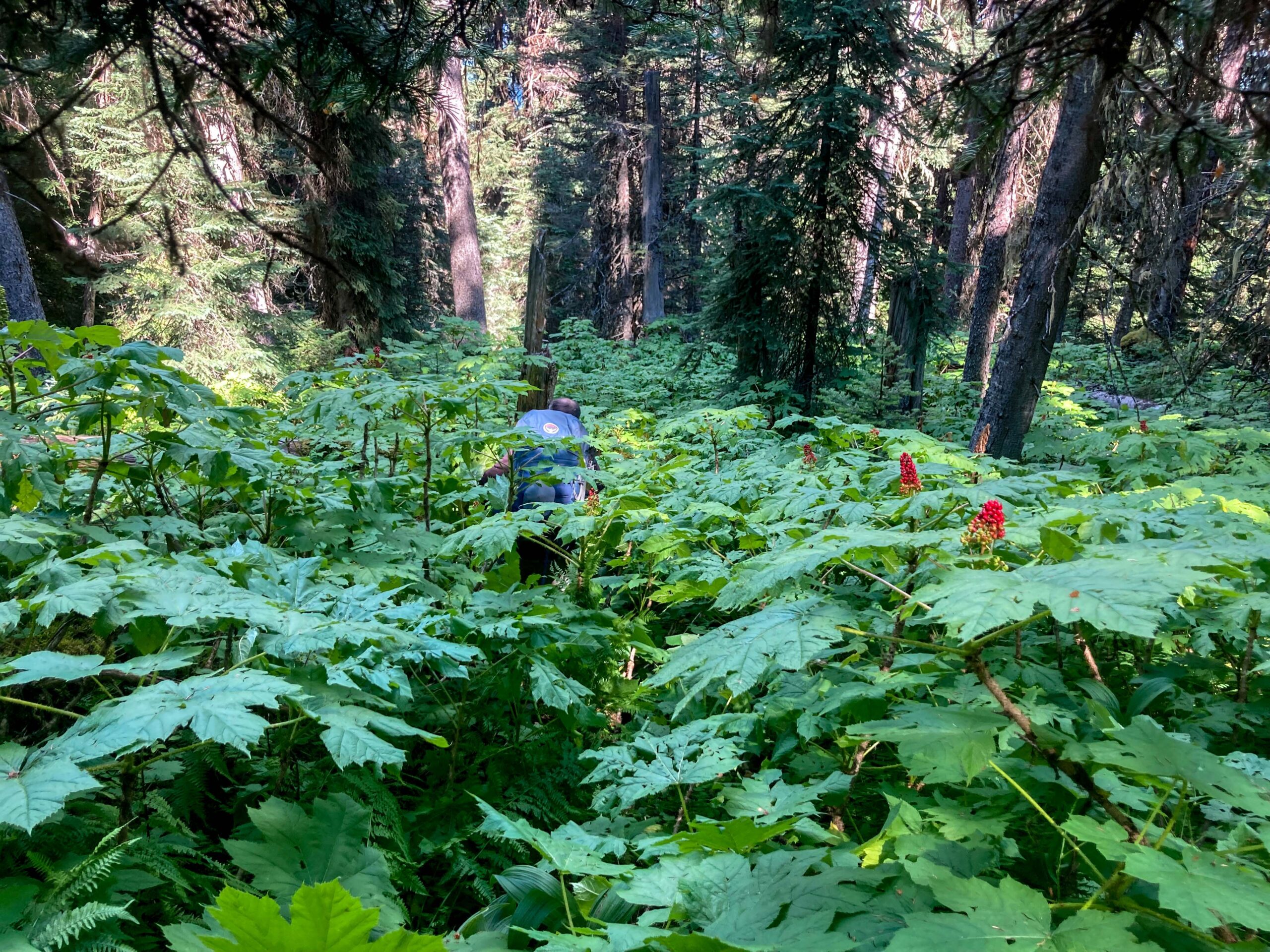
As the slope started to break and get steeper, the devils club started to make an appearance… the steeper the slope and the more blowdown, the taller and thicker the devils club. At one point we stopped to look around to take stock of the situation. The devils club was over our heads yet we could not see where to put our feet and the old blowdown on the steep slope seemed like a good recipe for a broken leg. We all agreed that this was possibly the worst bushwacking we had ever gotten ourselves into. However, at this point the only way to get out of this situation was to keep moving and enduring, with the hope that the insanity will eventually come to an end.
According to Tim’s recollection if they could make it to the old road it would be smooth sailing out. “The road was practically paved”. Of course when they did make it to the road, it was overgrown with willow and alder…. But hey, it wasn’t devils club!!! The trio had some jube jubes and the world seemed a bit better, and they were ready for the trek out along the old road.
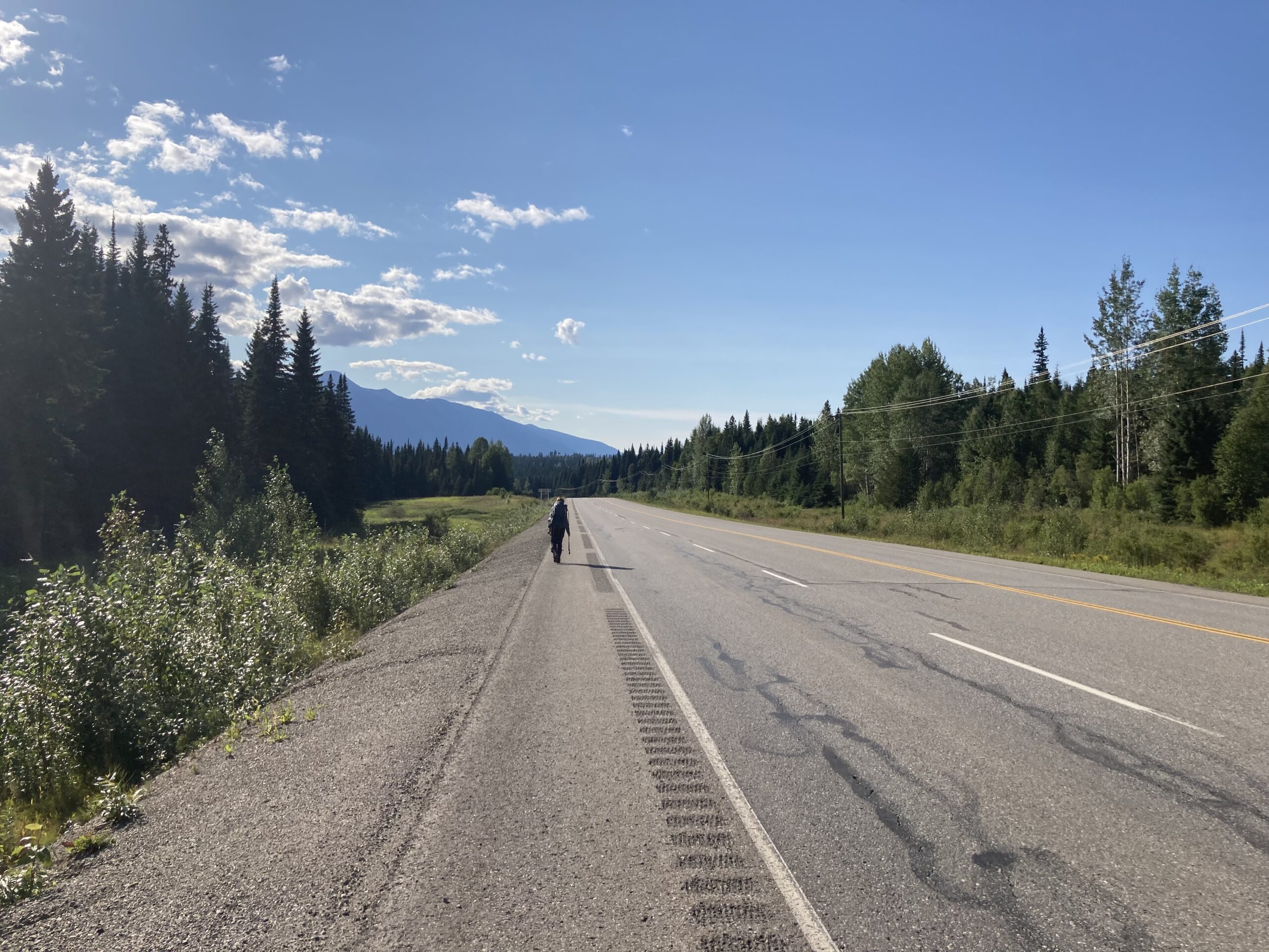
Late in the afternoon, they finally staggered out onto Hwy 16. Now just to walk back to the car; we had convinced ourselves that it was only 3 km but turned out being more like 5 km. At one point a kind “rustic” looking gentleman in an old rusted Ford pickup with a hot pink sea-doo in the box slowed down to take a look at these disheveled souls walking down the highway in the middle of nowhere. Andrea waved him on, but Hardy was convinced that we could have gotten a lift if we played our cards right.
Eventually we made it back to the vehicle tired and exhausted, but quite pleased that we had actually made the circuit. Could this have been the best hike of the year? On the way home we each bought three cans of pop at the Dome Creek Dinner. Dr. Pepper never tasted as good!