

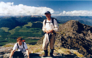
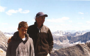
Fast forward to 2023; 20 years later. Im now 34, and Ive got a bit of a taste for both rock climbing, scrambling, and a little bit of mountaineering. I now actually own enough hardware to make it that final 6m and up to the summit. This occurs to me one rainy foggy day, as usual, paddling down Lanezi Lake with some friends on yet another incredible, life changing, bowron lakes circuit trip. Plans are made. A route is found. A new logging block is selected.
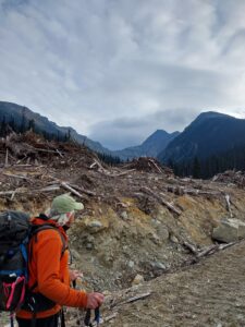
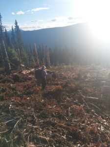
I took the back road from Likely after work to arrive near the bottom of Ishpa at around 930PM on Friday. My truck is shooting brake fluid right onto my exhaust manifold, because of course when something goes wrong, it has to go wrong on a steep hill at the furthest possible point from civilization. My dad arrives the following morning with a lot of brake fluid and some JB weld. Up we go to the cutblock, suffering almost zero setbacks. A large deac blocks our way to the edge of the block and I could conceivably ford it, but why risk it. We mash the JB weld onto the worn-through brake hardline and off we go.
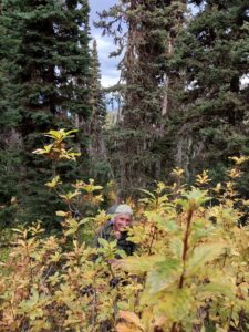
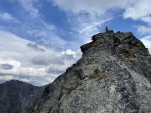
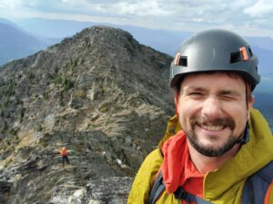
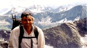
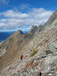
Suffering through quite a bit wet bush, it takes us ~2h to reach the sub-alpine. This, as both of us remember, is a dramatic improvement on last time, which stands out in both our minds as possibly the worst bit of bushwacking we've ever done in our careers. We hit the ridge, and the weather does not look promising. Dark clouds moving fast. Obvious rain to the east up the valley. As we move onwards and upwards the magnitude of the "ridgewalk" becomes more and more apparent. How the hell did I do this at 14 years old with no rope? Huge exposed drops with loose, choosy handholds. Balancing act knife edge ridges. And we havent even reached the first downclimb!
My dad pulls the pin first. He is feeling even more exposed than me, and does not think he will be able to make the return trip if it starts raining. After some triple checking, we turn around with still an estimated 3 or 4 hours of ridge to traverse before we make it to the "hard part". I think to myself, theres no way this is the route we took. It must have been one ridge over. Later, dad would find some old photos that perfectly confirm that this was indeed the exact route we took. We play around with rope systems for an hour or two on the ridge and turn to head back just as a major storm blows in. Some more extremely wet bushwacking later and we're back at the truck, cold and disheartened. The skies look like the kind of permanent gloom I learned to hate on the lower mainland. Light rain, light wind, high clouds, low clouds, and fog.
We InReach home base and get a weather update. Its almost unbelievable but tomorrow is supposed to be perfect. So we stick it out with a nice fire and a couple of beers.
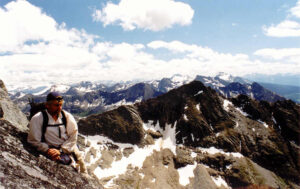
The following morning we head up past ghost lake to (almost for sure this time) climb Mt Matthew. Matthew is a classic in the area. There used to be an actual trail up to the alpine. This trail does not appear to exist any more, however there is new logging in the area quite high up so we are optimistic. We head out through the mess of fresh smashed logs and bush and a short time later (1hr and a bit??!?!) we pop out in a nice meadow and bowl/ The classic Matthew hike involves gaining the meadows via the hiking trail, then gaining the west ridge, as it appears to be the easiest way up and the going from there to what you think is the summit looks pretty easy. You then get completely shut down once youre up there by a very smooth very steep rock ridge. At this point you generally say "eh i got the views, I saw the glacier, I dont have time to go down and then back up, ill call this the top" and head home. Armed with this experience, I spotted a grassy route that snakes above a cliff band and gains the ridge AFTER the rocky bit. From there, surely the going will be easy. Dad doesnt think its possible to walk on such ground, but "lets see how far we get" he says. Off we go, and gain the ridge a short time of traversing steep grass later. To our dismay, looking east, all we see is huge black rocky towers and cliff faces. How did we miss this? Once again disappointed we spend some time farting around on the ridge. It produces good views of a crevasse filled glacier and ok views of ghost lake. Looking west, there is certainly no way from the regular "hikers summit" to where we stand and looking east there is certainly no way from where we stand to the summit approach ridge.
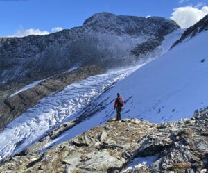
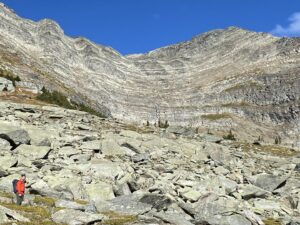
We decide to head down to get a closer look at the glacier. We discover a wolverine had approximately the same idea, and has had a bit of a spill down the steep ice on the north face before heading stoutly straight north across a crack filled glacier, somehow making it with almost no detours to the far side where presumably it climbed directly up the sheer rock/choss face.
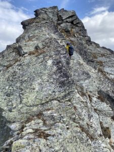
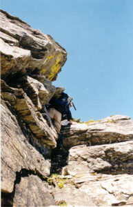
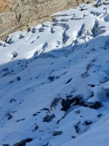
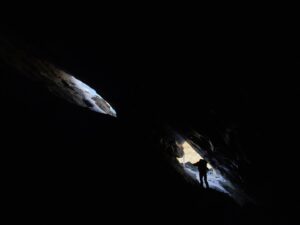
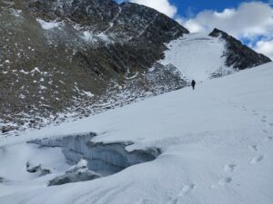
In typical Jorgenson fashion we keep poking ahead and keep poking ahead. Road blocks falling to curiosity one after another. At one point we become cliffed out and cannot descend further. Following the cliff top, we find a cave that leads under the ice. Sure enough, theres a feasible downclimb under the ice which leads us out another cave to the bottom of the cliff. At another point we almost turn back instead of venturing onto the ice with no crampons or axes. Taking a close and extended study, I find two perfect body belays: small depressions in the ice that give relief to the constant and risky slope, and big enough to allow a person to sit with their feet dug in and have no chance of being ejected by a sliding fall of the second. They look almost exactly 30m apart (we have a beal rando rope) and we set off. The belay works perfectly and we find ourselves in beautiful terrain, hiking across the ice with just enough crusty snow on top to make steps but not enough to bridge any hidden crevasses.
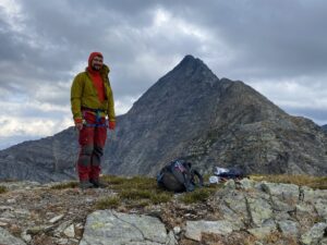
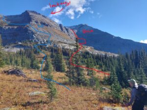
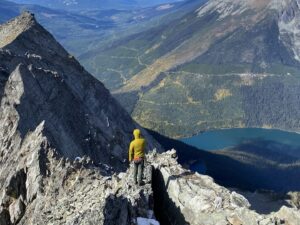
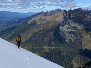
As we reach the top of the lower glacier, the summit approach finally becomes visible. You have two choices: climb the steep glacier or climb the rock to climbers right. We have none, its getting on to 4pm or so. We make the ridge and find ourselves directly above the bowl we started in. This route did not look feasible from the bottom but from up here it looks great to me. Dad thinks less of it, but I talk him into it. We successfully navigate a few downclimbs and cliff bands, and hit the meadows to great relief. We reverse our bushwack from earlier and get to the truck just as the sun sets. All in all a trip of a lifetime.
However, now armed with new beta, I will be returning next year. The plan is to climb our down-route, up the seemingly impassible rock face straight to the final ridge we got to. From here it looks pretty fun to break out the ice axes and the rope and pitch out the steep glacier. From there it looks like some mild scrambling to the summit ridge and I can mark it as conquered.
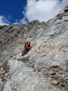
If you do this hike, I suggest a helmet and a confidence rope at the minimum. Stick very close together on the steep parts and watch for handholds breaking off. The rock to the right of the steep glacier looks fine to climb, but once you reach the top you will need to downclimb slightly to the ice, then cross the saddle, and climb back up the other side. Its unknown to me how steep this crossing might be, but if you biff it onto the steep glacier, you will get the fastest (and final) ride of your life.